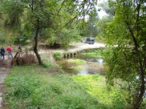

From the parking lot of “flipping” immediately before the mill with fulling mill, eco-trail starts on the road, parallel to the riverbed manual. Its source lies at the foot of a large catchment dry array, but because of the limited water flow near the valley ecosystem is rich in biodiversity.
To the left of the road you can see and visit existing mill and fulling and monitor flour milling with millstones powered by the waters of the river. MANUAL, washing fulling mill to taste honey produced from nearby hives owner of the mill or buy water Reseleshki onions.
The route continues along the road to the wooden bridge over the river. Manual. Across the river there is a recreation area with barbecue and stone steps lead to the hut “Lily of the Valley.”
Here the trail is divided into three:
In the first branch, signposting directs a narrow mountain path that in about 15 minutes leads to the rocky hill “fortress”. Along the way you can see the remains of the late antique fortress wall plantings of boxwood wild, beautiful wild flowers, herbs and mushrooms.
On the lawn of the hill is a separate checkpoint monitoring pavilion and scoreboard. From here panoramic views of the surrounding rocky hills and caves, rock formation “fiddle” and part of the canyon.
Tectonic comb nest large number of legally protected rare birds and karst formations are inhabited by colonies of bats. The slopes are dotted with more than 200 species of rare and beautiful plants.
The second branch, the left of the hut “Lily of the Valley”, a narrow forest path parallel to the river Manual, enter the canyon, part of an old Roman road which connected Oescus with Serdika. The trail passes through pine forest where encroaching on the comb than the amazing flora, they can see the remains of Roman houses and the fortification wall.
The rocky terrain that moves is curious and deposits of wild cabbage, wild flowers, many endemic species, carved as if herbarized, ivy trees in rocks and circling over the cliff birds add color to the scene. Proceed along severed scale – large, gently sloping monolithic block the size of a ten-storey building. Locals tell stories of a girl and refused to accept the Turkish faith that sprang from the top of the cliff. Grief rock split.
Along the canyon you can see some interesting rock formations, including the “fiddle”.
Outbreak is another naturally separate space in the rocks where smoke from open fire, like a stack its way between the rocks. It is accessed through the huge stone blocks which locals call “Stone River”.
Further pass along pen surrounded on one side by rocks and which in the past has been used as intended, and today has been transformed into a natural area for recreation.
The trail continues along the fence, which is to reach the former reserve for mouflon and out to the fountain of Dobrynin dollars at p. Manual. During the summer months coolness can be found in the pool with separate beach and water wheels or the built recreation areas of the lawn that are suitable for picnics.
In the third branch, eco-trail continues southwest along the road parallel to the river. Manual. Profilaktorium passes and reaches the meter. “Pladnishte” a newly constructed walking path handling. The path leads to a large meadow on which conducted local folk festivals. It is suitable for tent camping or just relaxing in the hot summer days, as it has separate spots. The road crosses the river on which it was built wooden footbridge and continues until natural landmark “Reseleshki dolls” artificial lake “Barrage” brought in sealing off the river. The lake is suitable for ribilov and summer outings.
