


During the first millennium BC instead of Balchik modern city, here was located the ancient Greek polis and trac “Kruni”. It occupies a large area surrounded by a massive fortified wall. At north reaches a modern bus station, at the west wall the main street runs west, covering part of the city center today. South wall starts at the Museum of History Balchik and continues south to the main street to south of the Art Gallery and river, starts north east wall along the river. During century III-VI after Hr. Dionisopolis’s ancient boundaries expand, reaching Jenny Bair and the sea. Limited archaeological studies conducted to date in the modern city are yet to enter into the secrets of the ancient Greek polis. They confirm that the polis led a trade overseas and had a good manufacturing base and rich hinterland: trace products ceramic workshops, vineyards, land for agricultural production, fishing.
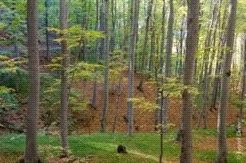
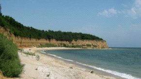
In the mid-century VI after Hr. a powerful earthquake followed by a creepy invasion maritime element, along the entire coast, cascading downtown. Following the landslide processes in the region are accelerated and the polis was collapsed to the ground. Survivor of the ancient city population moved to the new fort, which began to raise it since the late century V and early century VI. It is located above the plain plateau, northwest of the present town center Balch, the current district territory “Oorizont”, about 1 km from the beach. It occupies the corner of the plateau coast to 220 m high, formed between steep places and vertical sea south and a broad and deep valley in the east. The fortress has an irregular plan – very elongated from south-west to north-east. It is located less than 300 m from the southern slopes of the plateau from the coast and occupies sal edge of the terrace and the top of the slope to the valley to the east.
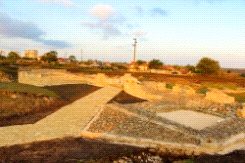
The territory of the city is nearly 150 acres, of which reason is not yet fully explored. There are disclosed some of the city walls, gates and defensive towers. It is believed that the construction of the fort was begun by Emperor Anastasius and was completed by Emperor Justinian I, assuming that completion works have been forced because of the catastrophic floods of the year. 544/545. After this year, the population apparently left Dionisopolis ancient and placed here.
The arrival of the Bulgarians on these lands is a turning point in the extensive process of ethnic and territorial changes, which began as a result of migrations. They are abandoned for a long time and remain desolate places for the important fortified empire. On their ruins remain firmly establishes bulgarians. Undoubtedly this process affects the destiny of the entire plains, known henceforth called Karvun land and settlement – Karvuna. The first three centuries of existence of the Bulgarian Danube were a period in which Bulgarian nationality is consolidated here. Situated near Pliska and Preslav metropolitan centers, the region is densely populated and built classrooms – forts and fortified urban settlements. Together with Drustur (Silistra today) exception to the rule are only the unfinished abandoned Bulgarians Han Asparuh near Niculitsel and one near Balchik, which apparently is not only the largest but also the only around the Delta to Pliska with priority in the defense strategy of the first Bulgarian empire.