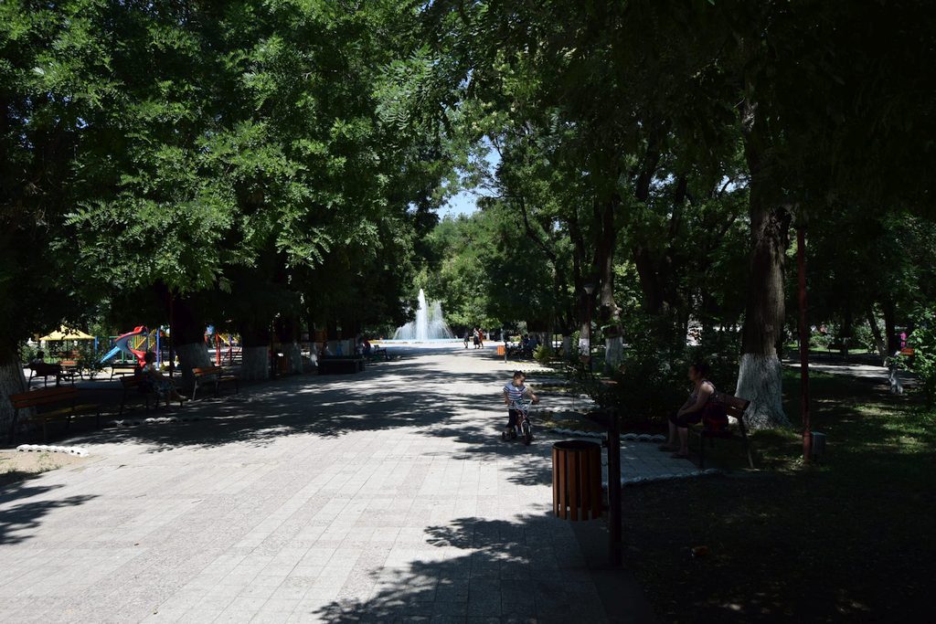


Central Park in Turnu Magurele, called the Public Garden, with an area of 2 hectares, was established in 1876 by a group of horticulturists from Bucharest, modeled after Prater Park in Vienna.
Within the park can be admired some exotic trees, such as “Sophora japonica” which blooms in August, a species of chestnut called “Aesculum hipocastanum”, “Thuya” trees, bushes of “Paeonia arborea” ‘with pale pink flowers and the “Mahonia aquifolium” with yellow flowers and permanent leaves.
After the Dacian-Roman wars from the years 101-106 AD, concluded with the victory of the Roman armies led by Emperor Trajan and by the conquest of Dacia, the city Turnu Magurele did not become part of the new province created. Emperor Trajan fortified the eastern border of Dacia on the line of Olt River, building the well known Limes Alutanus, consisting of forts and cities on both sides of the Olt River, from the Danube (from the Izlaz area today) until the Boița mountains. Historian Procopius of Caesarea presents Traian as the founder of the city Turris, identified by some historians with Turnu Magurele. Turnu is remembered between 1393-1394 by the city of the same name built by Mircea cel Bătrân at the confluence of the Danube with the River Olt (named so,after the shape of the city). In 1417 the city of Turnu came under Turkish rule and was transformed, along with a security zone (established in depth with a radius of 15 km from the city), in Turnu Raia. After the Russian- Turkish War from 1828-1829 (by the peace treaty of Adrianople from 1829) was established that the Raia Turnu to be abandoned by Turkish and returned to Romanian Country. The official establishment of the the city Turnu, known today as Turnu Măgurele (was named like this to distinguish itself from Drobeta Turnu Severin and Turnu Roșu), was held on February 27th, 1836 during the reign of Alexandru Ghica. The plan of the city was developed by German engineer Karl Zohl, having the form of two circles almost touching inside, with three long boulevards formed one on the common diameter of the two circles and two of them on two outside tangent strings at the small circle, the streets starting like rays in the form of inner semicircles of the big circle, setting, thereby, the streets, the squares, the places for own buildings and places of house area. Turnu Magurele has in its administrative componence, also the two old neighborhoods of the settlement, Magurele and Odaia, as well as the new neighborhood Taberei (popularly known as “Catanga” because the raising of this neighborhood began in 1960 when in Africa, namely Katanga, in Zaire province, was in full armed conflict, extremely wild).