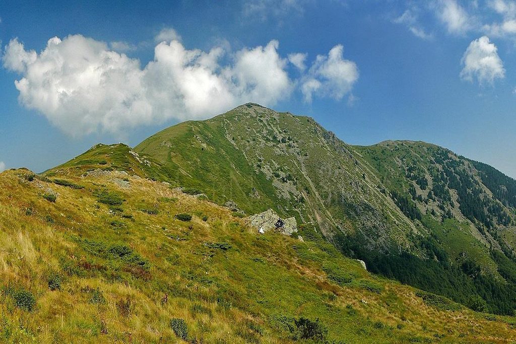


Midzhur Mountain(in serbian: Miџor or Midžor), has 2168 meters altitude, and it is the leader of Mount Chiprovskaa, a part of western Stara Planina. Located at the border between Bulgaria (Vidin Region) and Serbia, it is the highest peak of Serbia (outside the disputed region of Kosovo). From its foot originate the rivers Lom and Timok. On 23 February 2009, by order of Minister Chakarov, the top area was declared a protected one, with a surface area of 1509 acres. The objective is the preservation of typical landscapes and habitats of the plant species narcissiflora anemone, Alpine clematis, Zlatovrah and others. On January 17th, 2012 the protected area was increased to 1593 acres.
Only after the overthrow of border installations from the peak in the early 1990s, it became accessible for hiking. Therefore, the access paths and the whole area is kept largely in their original form.The tip of the Bulgarian side increased the most, between the two places.
Chuprene village – from Chuprene there are two possible approaches. By jeep from Chuprenska it can be reached within 17 km of dirt road, on farms and the cottage “Forest Paradise” (1450 m). Walking is more convenient to cross the river on the Manastirka and follow one of the two paths – “Stone Martynov,” “Bekinska shobarka” or to the “Forest Paradise” cottage, is a bit longer than nine kilometers.
From the cottage there is a marked path passing through “Chuprene” Biosphere Reserve from the main ridge of the saddle between Mount Replyanska (1969 m) and peak Hammer (1967 meters). In the southeast by Oba peak (2033 m), the saddle is reached, from beneath which start the rivers Lom and border area 336 Timok (1780 meters). Thus you should climb the northwest slope of Mount Midzor, reached after about an hour.The road from “Forest paradise” is longer than the road from the village of Gorni Lom, but easier.
From Gorni Lom are 7km of which the first two are paved, and there is located the cottage “Gorni Lom” (840 m). The building is a former frontier post. After another dirt road of 2-3km, this ends and begins the actual path.Is about 2-3 hours steep climbing on the saddle between the peaks Oba and Midzhur, on which is the terminal border 336. Here, the route joins the one from the village Chuprene.
This version is shorter, but therefore steeper.
It is possible to be reached also from the villages Martinovo and Repleana, Vidin, from the Bulgarian side and from the resort “Babin LAR” and the villages of the river Dol Aldi and to the Buche from the Serbian side. To climb the peak is advisable to be notified RDGP – Dragoman.