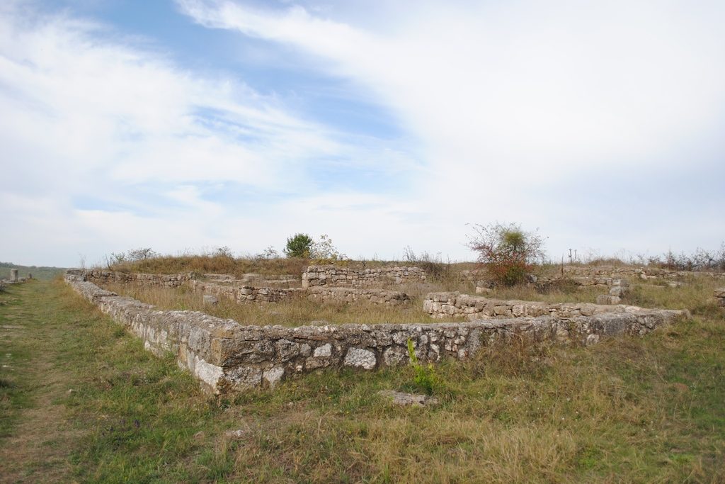


The first archeological researches were performed at the Citadel Adamclisi – Tropaeum Traiani by Grigore Tocilescu between the years 1891 – 1909, in order to be handed over by the great archeologist and historian Vasile Pârvan, starting with the year 1911. The citadel from Adamclisi (situated in the South – West side of the village, at approximately 600 m from it and at 1500 m from the triumph monument) was built by the emperor Traian for the families of the veterans who participated at the Dacian wars (and it is considered to be the greatest Roman civil settlements on the territory of Dobrogea). Already, before the year 170, we can talk about the existence in this place of a blooming urban center, raised under the emperor Marcus Aurelius at the degree of municipium. Starting with the IVth century A.D. the citadel was rebuilt by the emperor Constantin the Great, following the destructions instigated by the Goths. A last nourishing period is registered starting with the end of the Vth century and until the second half of the VIth century, when the citadel also became an important religious center. After almost six centuries of living, at the beginning of the VIIth century, the Avars – Slav invasions put an end to the living in these places (the citadel lost its urban character, indicating strong rural features), everything being covered in silence until up to the half of the XIXth century, when the area and, fundamentally, the name of the triumph monument drew the attention of the foreign travelers.
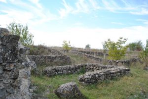
The interior wall met many construction phases, namely, a pre-Constantine phase starting with the end of the IIIrd century A.D. and a Constantine one, which follows the irregular of the plateau. The citadel benefited from four gates, arranged in the sense of the cardinal points (the Eastern gates, the Western gates, the Northern gates and the Southern gates). They made the connection with the imperial road which circulated through the Roman Dobrogea from North to South. Via principalis, oriented East – West (with a length of 300 m and a width of 14 m), was paved with big stone flagging. Its roadway side was of 7 m, being attached on one side and the other with gates destined for the pedestrian circulation (with a width of 3, 50 m). In the central part of the street there is a collecting channel (for the flow of the rainwater), built from bricks connected with mortar and strengthened with monolith stones. In its interior was also kept the fur ducts which ensured the flow of the drinking water.
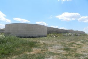
The plateau is surrounded on all the other sides by hills, more or less abrupt, which constitute a natural protection. The interior closes a surface of approximately 10 ha.
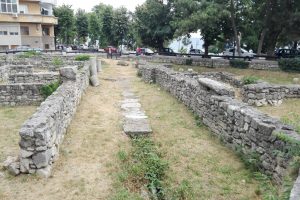
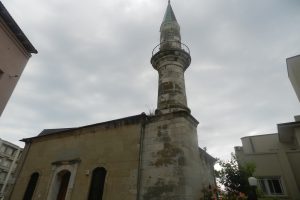
A proof of the religious role played as an Episcopal center in Dobrogea, is constituted by the multitude of basilicas built in the citadel, five situated in the interior, other two basilicas being built at the exterior (cemetery). The last ones are built on the plateau from the Northern side of the citadel, not far from the Western gate. In the interior of the citadel there are situated five basilicas discovered following the archeological diggings, which were: The “marble” basilica, the Basilica with transept and the Basilica A or simple.